The role of a cadastral surveyor in property boundary determination
Cadastral surveyors play a pivotal role in determining property boundaries, ensuring that land ownership is clearly defined. These professionals measure and map land parcels, which requires a mix of technical skills and legal knowledge. Their work is crucial not only for individual property owners but also for developers, government agencies, and planners, all of whom rely on accurate boundary definitions.
When engaging in property boundary determination, a cadastral surveyor begins by examining historical records, maps, and existing boundary markers. They look for clues that indicate where property lines are established. This comprehensive approach helps prevent future disputes, making their expertise invaluable in real estate transactions and land development projects.
The importance of accurate boundary mapping
Accurate boundary mapping is vital for various reasons. First, it helps property owners avoid disputes with neighbours over land rights. In many cases, unclear boundaries can lead to conflicts that may require legal intervention. Thus, having a precise understanding of property lines can save everyone time and money.
Furthermore, accurate mapping is essential for local councils and governmental bodies to facilitate planning and development. With clear boundaries, regulations regarding land use become much easier to enforce. From residential developments to large-scale infrastructural projects, accurate boundary mapping ensures that all parties adhere to the established legal frameworks.
The tools and techniques used by cadastral surveyors
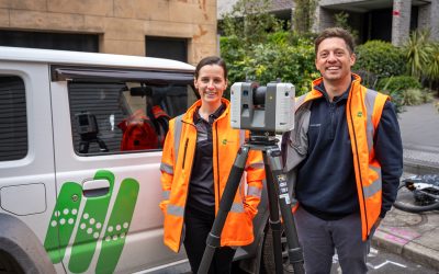
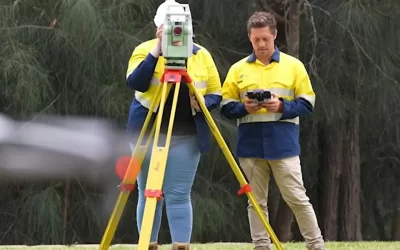
Today’s cadastral surveyors utilise a combination of traditional and modern techniques in their work. Tools like the theodolite and total station have been standard for many years, allowing for precise measurements of angles and distances. However, with advancements in technology, Global Positioning System (GPS) equipment has taken surveying to another level, enabling surveyors to achieve unparalleled accuracy.
Additionally, modern software applications allow cadastral surveyors to create detailed maps and models. Geographic Information Systems (GIS) and computer-aided design (CAD) software have revolutionised the industry, enabling surveyors to visualise and analyse geographical data effectively. These tools not only improve the accuracy of boundary mapping but also streamline workflow processes, enhancing productivity.
The impact of changing regulations on cadastral surveying
The landscape of property boundary laws is continually evolving, which poses both challenges and opportunities for all Sydney surveyors. Through changes in regulations, surveyors must navigate new legal requirements and ensure their practices comply with federal, regional, and local guidelines.
Understanding these regulations is paramount, as they directly influence how properties are measured, divided, and sold. Surveyors often find themselves at the forefront of legal discussions, providing expert testimony or evidence in disputes involving boundary lines.
Recent changes in property boundary laws
In recent years, various governments have introduced reforms aimed at simplifying property laws and making boundary disputes easier to resolve. For example, some jurisdictions have streamlined the process for land registration, allowing for quicker and more efficient transactions. However, these changes can sometimes result in ambiguity, particularly when new laws conflict with long-standing practices.
Moreover, emerging issues around environmental regulations and land use policies are also reshaping property boundary laws. As society becomes more focused on sustainable development, surveyors need to adapt their approaches accordingly. The challenge lies in effectively navigating both the legal landscapes and community expectations regarding property utilisation and environmental stewardship.
How cadastral surveyors adapt to regulatory changes
The ability to adapt is crucial for cadastral surveyors, as each regulatory change can greatly affect their day-to-day operations. Continuous education and training play significant roles, with surveyors regularly attending workshops and courses to stay up-to-date with current laws.
Furthermore, the integration of technology also assists surveyors in adapting to changes. By incorporating advanced software and methodologies, they can efficiently recalibrate their practices to align with new regulations. This adaptability enables them to remain relevant in an ever-evolving field while providing exceptional value to their clients.
The challenges faced by cadastral surveyors
Despite their essential contributions, cadastral surveyors encounter numerous challenges daily. One of the most pressing issues is managing complex property boundary disputes. These conflicts may arise due to unclear documentation, historical discrepancies, or changes in land use that were not formally recorded.
In many cases, surveyors must not only measure land but also mediate between disputing parties, aiming for a resolution that aligns with legal frameworks. This aspect of their job requires both technical proficiency and excellent interpersonal skills.
Dealing with complex property boundary disputes
When faced with complex disputes, cadastral surveyors employ meticulous investigation techniques. They delve into historical surveys, consult with legal files, and work with local authorities to gather comprehensive evidence. This often means collaborating with legal professionals who specialise in land rights and property law.
Understanding the legal implications of their work is vital, as surveyors frequently serve as expert witnesses in court. Their ability to present clear, well-supported findings can significantly influence the outcomes of disputes, making their role critical in such situations.
The impact of technological advancements on cadastral surveying
The rapid pace of technological advancement has revolutionised the field of cadastral surveying. The integration of drones and remote sensing technologies allows for faster and more accurate data collection, enabling surveyors to cover larger areas in shorter periods. This shift not only enhances precision but also improves efficiency, allowing surveyors to deliver results more quickly to their clients.
Moreover, advancements in data analysis tools provide cadastral surveyors with powerful insights, leading to smarter decision-making. By leveraging these tools, they can assess land for development or gauge how regulatory changes will impact different properties, ensuring that they remain proactive in their assessments.
The future of cadastral surveying
Looking ahead, the future of cadastral surveying appears dynamic, shaped by both societal needs and technological innovations. As urbanisation continues, the demand for accurate land measurement and boundary determination will only increase. Cadastral surveyors are well-positioned to meet these needs through their expertise and understanding.
Additionally, emerging issues such as climate change and sustainable development create new regulatory frameworks that will inevitably influence property boundaries. These developments will require surveyors to expand their skill sets and approaches to align with environmental considerations.
Predicted changes in property boundary regulations
In the coming years, changes in property boundary regulations are expected to become more pronounced. Governments may implement more stringent environmental controls and zoning laws to protect natural resources and promote sustainable land use. This shift will require cadastral surveyors to be vigilant, adapting their practices to ensure compliance while also advocating for landowner rights.
Furthermore, the digitisation of land records is likely to continue, making it essential for surveyors to be proficient in digital tools and technologies. Embracing this shift will not only improve their efficiency but also ensure they remain competitive in a rapidly changing industry.
The evolving role of cadastral surveyors in the future
As the field of cadastral surveying evolves, so too will the role of surveyors. They will increasingly find themselves not only as boundary experts but also as environmental stewards and community advocates. By embracing sustainability principles and incorporating them into their work, cadastral surveyors can contribute meaningfully to their communities.
In conclusion, the future of cadastral surveying brims with potential, highlighting the importance of continuous learning and adaptation. As property boundaries become even more critical in our fast-changing world, surveyors will remain at the heart of property law and land use discussions, ensuring clarity and reducing disputes.