What Does an Engineering Surveyor Do in Infrastructure Projects?
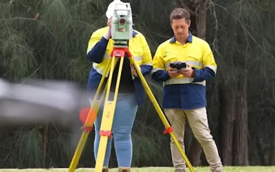
Engineering surveyors are crucial for successful infrastructure development. They use advanced surveying equipment to gather precise measurements and data, creating accurate representations of the site.
Key responsibilities include:
- Conducting detailed site assessments
- Creating precise topographical maps
- Verifying construction alignment with design specifications
- Ensuring compliance with regulatory standards
- Monitoring structural movements during construction
Engineering surveyors identify potential site challenges before construction begins. Their early detection of issues like unstable soil conditions or drainage problems prevents costly delays and design modifications.
A surveyor’s expertise extends throughout the project lifecycle:
- Pre-construction: Site analysis and feasibility studies
- During construction: Setting out works and alignment verification
- Post-construction: As-built surveys and quality control checks
This systematic approach to infrastructure development ensures projects meet design specifications while maintaining safety and quality standards.
How Is Engineering Surveying Different from Land Surveying?
Engineering surveying and land surveying serve distinct purposes in construction and development.
Land Surveying
Land surveyors focus on:
- Property boundaries
- Ownership rights
- Legal documentation of land parcels
Their work establishes property lines and resolves boundary disputes between landowners.
Engineering Surveying
Engineering surveys dive deeper into technical aspects:
- Construction-specific measurements for infrastructure design and implementation
- Precise topographical mapping to guide earthworks and structural placement
- Alignment data for roads, bridges, and utilities
- Construction staking to mark exact positions of project elements
- Quality control monitoring throughout development phases
Engineering surveyors integrate advanced technical knowledge with construction processes. They analyse soil conditions, calculate earthwork volumes, and provide detailed elevation data. This specialised expertise enables accurate project planning, precise construction execution, and ongoing quality assurance for infrastructure developments.
What Types of Engineering Surveys Are Used in Construction?
Survey engineers employ several specialised survey types to ensure precise infrastructure development:
1. Topographic Surveys
- Detailed mapping of land contours and elevations
- Documentation of natural features and existing structures
- Essential for site planning and earthwork calculations
2. As-Built Surveys
- Verification of completed construction against design specifications
- Recording actual positions of installed infrastructure
- Critical for quality control and future maintenance
3. Control Surveys
- Establishment of reference points and benchmarks
- Creation of precise coordinate systems
- Basis for all subsequent construction measurements
4. Monitoring Surveys
- Regular checks of structural movement and settlement
- Detection of potential stability issues
- Protection of surrounding properties during construction
These survey types create a comprehensive framework for infrastructure projects, enabling accurate planning, precise execution, and reliable quality assurance throughout the construction process.
Why Are Engineering Surveyors Essential in Large-Scale Developments?
Engineering surveyors are crucial for large-scale infrastructure projects. Their accurate measurements lay the groundwork for successful project execution, from initial site preparation to final construction stages.
These specialists provide:
- Exact measurements for positioning structures
- Immediate data collection during construction phases
- Quality control monitoring throughout development stages
Survey engineers spot potential site issues before they become expensive problems. Their skills in mapping terrain help project managers make informed decisions about:
- What needs to be done to prepare the site
- How to strategically place equipment
- Calculating the quantity of materials required
The impact of engineering surveyors goes beyond basic measurements. Their work directly affects:
- The accuracy of project timelines
- Budget management
- Strategies for assessing risks
- Validation of structural integrity
Even a small mistake in measurement can lead to significant delays and budget overruns in a project. Engineering surveyors prevent these problems by conducting thorough accuracy checks and continuously monitoring the development process.
What Skills and Qualifications Should a Survey Engineer Have?
A successful survey engineer needs specific technical expertise and qualifications to deliver accurate infrastructure planning results:
Essential Technical Skills:
- Proficiency in modern surveying equipment operation
- Advanced mathematics and geometry knowledge
- Expert use of CAD software and GIS systems
- Data analysis and interpretation capabilities
- Understanding of construction methodologies
Required Qualifications:
- Bachelor’s degree in Surveying, Civil Engineering, or related field
- Professional registration with relevant surveying boards
- Industry certifications in specialised survey techniques
- Minimum 2-3 years practical field experience
Key Personal Attributes:
- Precise attention to detail
- Strong problem-solving abilities
- Physical stamina for fieldwork
- Clear communication skills
- Ability to work in varied weather conditions
Survey engineers must stay current with emerging technologies and industry standards through continuous professional development and training.
How Do Survey Engineers Support Road and Bridge Construction?
Survey engineers play a crucial role in road and bridge construction by providing accurate measurements and detailed maps. Their work begins with thorough site evaluations to determine the exact state of the ground and the locations of any existing infrastructure.
Key responsibilities include:
- Setting out road alignments and bridge positions using advanced GPS technology
- Calculating earthwork volumes for cut-and-fill operations
- Marking critical reference points for construction teams
- Verifying bridge pier locations and deck elevations
During the construction phase, survey engineers carry out regular checks to:
- Monitor any settling or movement of structures
- Ensure vertical and horizontal alignment is correct
- Confirm that design specifications are being followed
- Record as-built conditions for future reference
These professionals use specialised equipment like total stations and 3D scanners to achieve millimetre-level precision. Their expertise ensures road gradients meet safety standards and bridge components align perfectly during assembly.
The data collected by engineering surveyors helps project managers make informed decisions about construction sequencing and potential adjustments needed during the build phase.
Where Can I Hire an Engineering Surveyor?
Specialised surveying firms offer comprehensive engineering surveys for infrastructure projects across NSW and QLD. These firms maintain teams of qualified survey engineers equipped with advanced surveying technology and expertise.
Many construction and civil engineering companies provide in-house engineering surveyors for precise project measurements and ongoing site monitoring.
Wumara Group delivers professional engineering surveying services with:
- Competitive, negotiable rates
- Proven track record in telecommunications and government projects
- Indigenous procurement consulting
- End-to-end project management solutions
Contact Wumara today for expert engineering surveying services tailored to your infrastructure development needs.