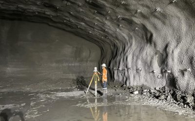
Introduction to Surveys
Surveys are a crucial aspect of property development, construction, and land ownership. They provide essential information about property boundaries, topography, and other features that can impact the value and usability of a property. In this section, we will introduce the basics of surveys, including the different types of surveys, the evolution of surveying techniques, and the importance of working with an experienced team.
Understanding the Basics of Surveys
A survey is a detailed map of a property that shows its boundaries, dimensions, and other features. It is typically created by a licensed surveyor who uses specialized equipment and techniques to gather accurate data. Surveys can be used for a variety of purposes, including determining property boundaries, identifying potential issues with a property, and planning for construction or development. For example, a contour survey can help identify steep slopes and gentle slopes, which can impact the design and construction of a building or retaining walls.
The Evolution of Surveying Techniques
Surveying techniques have evolved significantly over the years, from traditional methods using chains and compasses to modern technologies such as GPS and laser scanning. Today, surveyors use a range of tools and techniques to gather accurate data, including aerial photography, satellite imaging, and ground-penetrating radar. These advances have improved the accuracy and efficiency of surveys, making it possible to gather detailed information about a property quickly and cost-effectively. Cadastral surveys, in particular, have become more precise, allowing for accurate determination of property boundaries and land ownership.
Understanding Contour Surveys
Contour surveys are essential tools in the field of landscape design and water flow management. By mapping the contours of the land, these surveys provide vital data about the topography, which can significantly influence design decisions. The process involves measuring the elevation of various points on a piece of land and connecting them to create contour lines. These lines represent areas of equal elevation and are crucial for understanding how water will flow across the landscape. A contour survey helps in making informed decisions during the construction process by providing crucial insights into the terrain and its implications for building placement and compliance with local regulations.
In Australia, where diverse landscapes range from coastal regions to arid deserts, contour surveys play a critical role in ensuring that landscape designs are not only aesthetically pleasing but also functional. The accurate representation of land contours helps in predicting water movement, which is particularly important in managing stormwater and preventing erosion. Furthermore, the unique biodiversity found in Australian ecosystems often necessitates careful planning to preserve native flora and fauna, making contour surveys an indispensable part of sustainable landscape practices.
Types of Surveys
There are several types of surveys, each with its own specific purpose and application. Some common types of surveys include boundary surveys, identification surveys, contour surveys, and detail surveys. Boundary surveys are used to determine the exact location of a property’s boundaries, while identification surveys are used to identify the location of a property and its boundaries. Contour surveys, on the other hand, provide a detailed map of a property’s topography, including its elevation, slope, and other features. Detail surveys are used to gather detailed information about a property, including its boundaries, dimensions, and other features.
The Importance of Accurate Measurements
Accuracy in contour surveys cannot be overstated. Even slight discrepancies in elevation measurements can lead to significant issues in water flow management. For instance, if a contour line is inaccurately placed, it may result in water pooling in unintended areas, causing potential flooding or erosion. Therefore, employing advanced surveying techniques and technologies, such as GPS and laser scanning, and ensuring reliable survey data is essential for achieving precise results. Additionally, regular updates to these surveys can be beneficial, especially in regions prone to environmental changes or human activities that alter the landscape, ensuring that the data remains relevant and reliable over time.
Applications in Landscape Design
In landscape design, contour surveys inform various aspects of the project, from the placement of pathways to the selection of plant species. Designers rely on this data to create spaces that harmonise with the natural terrain, enhancing both functionality and aesthetics. For example, understanding the slopes and depressions of a site allows designers to position features like ponds, gardens, and seating areas in ways that complement the natural flow of water. Moreover, contour surveys can also assist in the creation of terraced gardens, which not only mitigate soil erosion but also provide a visually appealing structure that maximises usable space in hilly or uneven terrain. This thoughtful integration of topographical data into design not only promotes environmental stewardship but also enriches the overall user experience in outdoor spaces.
Water Flow Management: A Critical Component
Effective water flow management is crucial in preventing erosion, managing stormwater, and maintaining the health of the landscape. Contour surveys provide the foundational data needed to develop strategies that manage water flow effectively. By analysing the contours, landscape architects can design systems that direct water to where it is needed most, whether that be for irrigation, drainage, or aesthetic water features. It is also essential to ensure these designs comply with council requirements to avoid legal issues and ensure proper zoning compliance.
Preventing Erosion
Erosion is a significant concern in many Australian landscapes, especially in areas prone to heavy rainfall. Contour surveys help identify vulnerable areas where soil may be washed away during storms. By designing landscapes that work with the natural contours, it is possible to create barriers and channels that slow down water flow, allowing it to percolate into the ground rather than wash away precious topsoil. Furthermore, the implementation of vegetation such as native grasses and shrubs can enhance these efforts, as their root systems help to bind the soil together, reducing the risk of erosion even further. This approach not only protects the soil but also promotes biodiversity, as these plants provide habitats for various species, contributing to a healthier ecosystem.
Stormwater Management
In urban settings, managing stormwater is a pressing issue. Contour surveys enable planners to design systems that effectively capture and redirect stormwater runoff, reducing the risk of flooding and water pollution. By understanding the land’s natural drainage patterns, landscape architects can create retention basins, swales, and other features that mitigate the impact of heavy rainfall. Additionally, incorporating permeable surfaces in urban design can significantly enhance stormwater management. These surfaces allow water to infiltrate the ground rather than run off into drainage systems, thus replenishing groundwater supplies and reducing the burden on municipal stormwater systems. The integration of green roofs and rain gardens can also play a pivotal role in this strategy, providing not only functional benefits but also aesthetic enhancements to the urban landscape. Local councils often mandate these surveys to ensure that developments comply with regulations and do not negatively impact surrounding properties.
Integrating Contour Surveys with Sustainable Practices
As sustainability becomes an increasingly important consideration in landscape design, our dedicated team ensures that contour surveys play a pivotal role in integrating eco-friendly practices. By providing a clear understanding of the land’s topography, these surveys facilitate the implementation of sustainable drainage systems and natural landscaping techniques that enhance biodiversity and conserve water.
Promoting Biodiversity
Designing landscapes that promote biodiversity is essential for creating resilient ecosystems. Contour surveys allow designers to identify areas where native plants can thrive, ensuring that the landscape supports local wildlife and surrounding properties. By planting native species in the right locations, it is possible to create habitats that attract birds, insects, and other wildlife, contributing to the overall health of the ecosystem.
Water Conservation Techniques
Incorporating water conservation techniques into landscape design is vital, especially in arid regions of Australia. Contour surveys can help identify areas where rainwater harvesting systems can be effectively implemented. By capturing and storing rainwater, landscapes can reduce reliance on mains water for irrigation, promoting a more sustainable approach to landscape management. These techniques are particularly beneficial when planning the design and construction of a new home.
The Process of Conducting a Contour Survey
Conducting a contour survey involves several steps, each of which is crucial for obtaining accurate data. The process typically begins with site selection and preparation, followed by performing a field survey to collect data, and then analysis. Understanding this process can help stakeholders appreciate the value of contour surveys in landscape design and water flow management.
Site Preparation and Selection
The first step in conducting a contour survey is selecting the appropriate site and preparing it for surveying. This may involve clearing vegetation and ensuring that the area is accessible for surveying equipment. Proper preparation is vital to ensure that the survey can be carried out efficiently and accurately.
Data Collection Techniques
Modern contour surveys utilise various data collection techniques, including traditional methods such as levelling and more advanced technologies like GPS and drones. Each method has its advantages, and the choice often depends on the size and complexity of the site. Drones, for example, can quickly cover large areas and provide high-resolution data, while traditional methods may be more suitable for smaller, more intricate sites. Engineers, along with architects, rely on these surveys to comprehend site topography, plan site works, and ensure effective drainage and structural integrity during development projects.
Working with an Experienced Team
When it comes to surveys, it is essential to work with an experienced team of surveyors who have the skills and expertise to gather accurate data. A registered cadastral surveyor, for example, has the training and experience to perform cadastral surveys and provide comprehensive surveys that meet the needs of clients. By working with an experienced team, property owners can ensure that their surveys are accurate, reliable, and meet their specific needs. This is particularly important for clients who need to re-establish boundaries or resolve legal disputes related to property ownership.
Using Survey Plans
Survey plans are detailed maps of a property that show its boundaries, dimensions, and other features. They are typically created by a licensed surveyor and are used to provide accurate information about a property. Survey plans can be used for a variety of purposes, including planning for construction or development, identifying potential issues with a property, and determining property boundaries. By using survey plans, property owners can make informed decisions about their property and ensure that their development plans are accurate and compliant with local regulations. For instance, a survey plan can help identify any restrictions or limitations on a property, such as easements or covenants, which can impact the design and construction of a building or other structure.
Challenges and Considerations
While contour surveys offer numerous benefits, there are challenges and considerations that must be addressed. Understanding these challenges can help ensure that the surveys are conducted effectively and that the resulting data is utilised to its fullest potential. Additionally, producing an Identification Survey Plan and conducting contour surveys are often a legal requirement for compliance with local regulations and legal standards in land development.
Environmental Factors
Environmental factors can significantly impact the accuracy of contour surveys. Weather conditions, such as rain or strong winds, can hinder data collection efforts. Additionally, changes in vegetation or land use can alter the landscape, necessitating regular updates to contour surveys to maintain accuracy.
Note that regulatory requirements often mandate pairing a contour survey with a soil test to ensure comprehensive planning and compliance.
Cost and Resource Management
Conducting a contour survey can involve considerable costs, particularly when employing advanced technologies. It is essential for stakeholders to weigh the benefits against the costs and consider how the data will be used in the long term. Proper resource management can help ensure that the investment in a contour survey yields significant returns in terms of effective landscape design and water flow management, especially when supported by a detailed plan.
Conclusion: The Future of Contour Surveys in Landscape Design
As the demand for sustainable landscape design and effective water flow management continues to grow, the role of contour surveys will become increasingly important. By providing essential data about the land’s topography, these surveys enable landscape architects and planners to create designs that are both functional and environmentally friendly. Ensuring that these surveys are conducted by professionals registered with the surveyors board is crucial for maintaining high standards and accuracy.
Looking ahead, advancements in surveying technology will likely enhance the accuracy and efficiency of contour surveys. As tools become more sophisticated, the potential for innovative landscape designs that harmonise with natural water flow patterns will expand. Ultimately, embracing contour surveys as a fundamental aspect of landscape design will contribute to healthier ecosystems and more resilient communities across Australia.


