In recent years, the demand for efficient and precise underground infrastructure planning has surged. As urban areas continue to expand and develop, the need for comprehensive mapping of underground utilities has become increasingly critical. 3D utility mapping has emerged as a revolutionary solution, offering a detailed and accurate representation of subsurface utilities by leveraging advanced technology and the latest equipment to improve accuracy and efficiency. This article explores the significance of 3D utility mapping, its benefits, and its potential to transform the future of infrastructure planning.
Introduction to Underground Utility Locating
Underground utility locating is a critical process that involves identifying and mapping the exact location of underground utilities such as pipes, cables, and conduits. This essential service ensures that construction and excavation projects can proceed safely, minimising the risk of accidental damage to existing utilities. Utility locating services play a vital role in protecting underground assets, reducing the likelihood of utility strikes that can lead to costly repairs, project delays, and service interruptions.
Modern underground utility locating services rely on cutting-edge technology, including ground penetrating radar (GPR) and electromagnetic locators, to detect and map buried utilities with a high level of accuracy. These advanced technologies enable contractors and construction companies to obtain reliable subsurface utility information, which is vital for planning and executing complex projects. By providing detailed utility data, these services assist industries in making informed decisions, ensuring safe excavation practices, and maintaining the integrity of essential services such as water, gas, and telecommunications.
The Importance of Accurate Utility Mapping
Accurate utility mapping is essential for several reasons, particularly in urban environments where multiple utilities coexist beneath the surface. Traditional methods of utility mapping often fall short, leading to inefficiencies and increased risks during construction and maintenance projects. Modern utility mapping addresses these challenges by offering a comprehensive range of services and equipment designed to handle the complexities of urban infrastructure.
Reducing Risks and Enhancing Safety
One of the primary advantages of 3D utility mapping is its ability to reduce risks associated with underground excavation. Proper utility mapping is essential before any dig or excavation work begins to prevent damage and ensure safety. By providing a detailed view of existing utilities, project managers can avoid accidental strikes, which can lead to costly damages, project delays, and even injuries. A comprehensive understanding of the subsurface landscape ensures that workers are better equipped to navigate potential hazards safely.
Moreover, the integration of 3D utility mapping into safety protocols can significantly enhance training for workers. By visualising the intricate web of utilities beneath the ground, new employees can gain a clearer understanding of the potential dangers they may encounter. This proactive approach not only helps in preventing accidents but also fosters a culture of safety within the workforce, where awareness and caution are paramount.
Improving Project Efficiency
3D utility mapping significantly enhances project efficiency. By utilising advanced technologies such as Ground Penetrating Radar (GPR) and Geographic Information Systems (GIS), planners can gather accurate data on the location and condition of utilities. This information allows for more informed decision-making, reducing the time spent on site investigations and enabling faster project completion. Accurate utility mapping is a crucial step in any construction project to avoid delays and ensure safety by preventing damage to underground infrastructure.
Facilitating Better Communication
In many cases, multiple stakeholders are involved in infrastructure projects, including contractors, engineers, and local authorities. 3D utility mapping provides a visual representation of underground utilities that can be easily shared among all parties. This transparency fosters better communication and collaboration, ultimately leading to more successful project outcomes.
Technological Advancements in 3D Utility Mapping
The evolution of technology has played a pivotal role in the advancement of 3D utility mapping. Various tools and techniques have emerged, providing unprecedented accuracy and detail in subsurface mapping. Underground locating services and service locating have greatly benefited from these technological advancements, enabling more accurate and comprehensive identification and mapping of underground utilities such as gas, water, sewer, electric, and telecommunications lines.
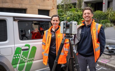
Ground Penetrating Radar (GPR)
Ground Penetrating Radar is one of the most widely used technologies in 3D utility mapping. It employs radar pulses to image the subsurface, allowing for the detection of utilities, voids, and other anomalies. GPR is also highly effective for the detection and mapping of underground cables, helping to accurately identify cable locations and prevent accidental damage during excavation. GPR is particularly effective in urban environments, where traditional excavation methods may be impractical or too risky.
Geographic Information Systems (GIS)
GIS technology complements GPR by enabling the integration of utility data into a comprehensive spatial database. This allows for the visualisation and analysis of underground utilities in relation to surface features. By combining GPR data with GIS, planners can create detailed 3D models that enhance understanding and facilitate better planning.
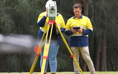
Drone Technology
Drone technology is also making its mark on 3D utility mapping. Equipped with advanced sensors, drones can capture high-resolution aerial imagery and conduct surveys of large areas quickly and efficiently. This capability is particularly beneficial for mapping extensive infrastructure networks, providing a broader context for underground utilities.
Applications of 3D Utility Mapping
The applications of 3D utility mapping are vast and varied, spanning multiple sectors and industries. Its versatility makes it an invaluable tool for infrastructure planning and management. 3D utility mapping is often integrated with specialised surveying services to support telecommunications and infrastructure projects.
Urban Development Projects
In urban development, 3D utility mapping plays a crucial role in the planning and execution of construction projects. By understanding the location and condition of existing utilities, advanced mapping technologies are used to accurately locate underground utilities before construction begins. Developers can design projects that minimise disruptions and ensure compliance with local regulations. This proactive approach not only saves time but also reduces costs associated with unforeseen complications.
Utility Management and Maintenance
Utility companies benefit significantly from 3D mapping technologies. By maintaining up-to-date maps of underground utilities, knowing exactly where utilities are located is crucial for streamlining maintenance and preventing service disruptions. Companies can streamline maintenance operations and respond more effectively to outages or emergencies. This data-driven approach enhances service reliability and customer satisfaction.
Environmental Assessments
3D utility mapping is also instrumental in environmental assessments. By identifying the location of utilities in relation to sensitive ecological areas, planners can make informed decisions that protect the environment while facilitating necessary infrastructure developments. This balance is essential for sustainable urban growth.
Safe Excavation Practices
Safe excavation practices are fundamental to preventing damage to underground utilities and safeguarding workers and the community. Before any excavation or digging begins, it is essential to identify the location of underground utilities such as pipes and cables. Utility locating services provide the accurate and reliable utility data needed to plan and execute safe excavation, significantly reducing the risk of utility strikes and costly repairs.
The use of advanced technologies, including ground penetrating radar (GPR) and other innovative tools, allows for the precise detection and mapping of underground assets. These technologies help contractors and construction companies identify potential safety hazards, such as buried cables and pipes, before excavation work commences. By utilising up-to-date utility plans and maps, project teams can plan their work around existing utilities, minimising the risk of accidental damage and ensuring compliance with safety regulations.
Highly trained personnel and specialised equipment are essential components of safe excavation practices. Contractors must adhere to strict safety protocols, regularly update their training, and follow industry best practices to handle complex excavation projects. Identifying and mapping the exact location of buried utilities is not only vital for project success but also for protecting essential services and maintaining community safety. By prioritizing safe excavation, companies can avoid costly mistakes, enhance efficiency, and deliver reliable results for their clients.
The Future of 3D Utility Mapping
As technology continues to advance, the future of 3D utility mapping looks promising. The integration of artificial intelligence (AI) and machine learning into mapping processes is set to enhance data analysis and predictive modelling capabilities.

Artificial Intelligence and Machine Learning
AI and machine learning can analyse vast amounts of data generated by 3D utility mapping, identifying patterns and trends that may not be immediately apparent. This capability can lead to more accurate predictions regarding utility maintenance needs, helping companies allocate resources more efficiently.
Integration with Smart City Initiatives
3D utility mapping is poised to play a significant role in the development of smart cities. As urban areas increasingly adopt smart technologies, the need for accurate and up-to-date utility mapping becomes paramount. Integrating 3D mapping data with smart city infrastructure can enhance urban planning, resource management, and overall quality of life for residents.
Enhanced Collaboration Across Sectors
The future of 3D utility mapping will likely see enhanced collaboration across various sectors, including government, private industry, and academia. By sharing data and best practices, stakeholders can work together to create more resilient and efficient infrastructure systems that benefit everyone.
Challenges and Considerations
Despite its many advantages, the implementation of 3D utility mapping is not without challenges. Addressing these issues is crucial for the successful adoption of this technology.
Data Accuracy and Reliability
Ensuring the accuracy and reliability of data collected through 3D utility mapping is paramount. Inaccurate data can lead to costly mistakes and undermine the benefits of the technology. Continuous advancements in mapping techniques and validation processes are essential to maintain high standards of data quality.
Cost Considerations
The initial investment in 3D utility mapping technology can be significant, particularly for smaller companies or municipalities. However, the long-term benefits, including reduced project delays and improved safety, often outweigh the upfront costs. Developing cost-effective strategies for implementation will be key to wider adoption.
Training and Skill Development
As 3D utility mapping technologies evolve, the need for skilled professionals who can effectively utilise these tools will increase. Training programmes and educational initiatives will be vital in ensuring that the workforce is equipped with the necessary skills to harness the full potential of 3D mapping.
Conclusion
3D utility mapping represents a significant advancement in the field of underground infrastructure planning. By providing accurate, detailed, and easily interpretable data, this technology enhances safety, efficiency, and collaboration among stakeholders. As advancements continue and the integration of AI and smart technologies becomes more prevalent, the future of 3D utility mapping is poised to reshape the landscape of urban planning and infrastructure management.
In an era where urbanisation is rapidly increasing, the importance of effective utility mapping cannot be overstated. Embracing 3D utility mapping is not merely an option; it is a necessity for sustainable and efficient infrastructure development. The potential benefits are immense, paving the way for a more resilient and well-planned urban future.
For more information or to discuss your utility mapping needs, contact us today.